
파일:West Midlands UK location map.svg

SVG 파일의 PNG 형식의 미리보기 크기: 800 × 547 픽셀. 다른 해상도: 320 × 219 픽셀 | 640 × 437 픽셀 | 1,024 × 700 픽셀 | 1,280 × 875 픽셀 | 2,560 × 1,750 픽셀 | 1,425 × 974 픽셀
원본 파일 (SVG 파일, 실제 크기 1,425 × 974 픽셀, 파일 크기: 1.35 MB)
| 설명 |
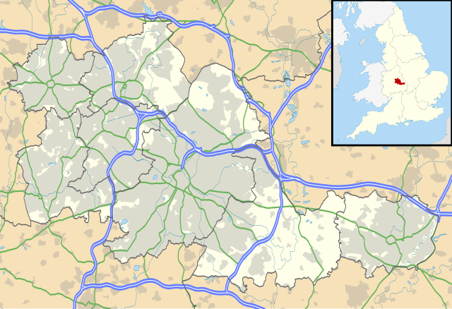
Map of the West Midlands, UK with the following information shown:
Equirectangular map projection on WGS 84 datum, with N/S stretched 160% Geographic limits:
|
| 날짜 | |
| 출처 |
|
| 저자 | Nilfanion, created using Ordnance Survey data |
| 저작권 (이 파일을 인용하기) |
이 파일은 크리에이티브 커먼즈 저작자표시-동일조건변경허락 3.0 Unported 라이선스로 배포됩니다. 저작자표시: Contains Ordnance Survey data © Crown copyright and database right
|
| 다른 버전 | File:West Midlands UK district map (blank).svg - Blank map |
.svg)
파일 역사
날짜/시간 링크를 클릭하면 해당 시간의 파일을 볼 수 있습니다.
| 날짜/시간 | 섬네일 | 크기 | 사용자 | 설명 | |
|---|---|---|---|---|---|
| 현재 | 2010년 9월 27일 (월) 04:17 | | 1,425 × 974 (1.35 MB) | Nilfanion | {{Information |Description=Map of the West Midlands, UK with the following information shown: *Administrative borders *Coastline, lakes and rivers *Roads and railways *Urban areas Equirectangular map projection on WGS 84 datu |
이 파일을 사용하는 문서
다음 문서 4개가 이 파일을 사용하고 있습니다:
이 파일을 사용하고 있는 모든 위키의 문서 목록
다음 위키에서 이 파일을 사용하고 있습니다:
- ar.wikipedia.org에서 이 파일을 사용하고 있는 문서 목록
- ast.wikipedia.org에서 이 파일을 사용하고 있는 문서 목록
- bg.wikipedia.org에서 이 파일을 사용하고 있는 문서 목록
- ceb.wikipedia.org에서 이 파일을 사용하고 있는 문서 목록
- en.wikipedia.org에서 이 파일을 사용하고 있는 문서 목록
- Moseley
- Moseley and Kings Heath (ward)
- Coventry Cathedral
- Coventry Transport Museum
- 2002–03 FA Premier League
- 2003–04 FA Premier League
- Walsall
- West Bromwich
- Dudley
- Tipton
- Birmingham Airport
- Soho House
- Aston
- Smethwick
- Oldbury, West Midlands
- Rowley Regis
- Birmingham Town Hall
- Birmingham Museum and Art Gallery
- Aldridge
- Sutton Coldfield
- Bilston
- Sutton Park, West Midlands
- Blackheath, West Midlands
- Black Country Living Museum
- Dudley Castle
- Willenhall
- Halesowen
- Knowle, West Midlands
- Stourbridge
- Brierley Hill
- Brownhills
- Hampton in Arden
- Spaghetti Junction, Birmingham
- Edgbaston
- Sedgley
- Harborne
- Soho, West Midlands
- Birmingham Botanical Gardens, England
- 2004–05 FA Premier League
- Thinktank, Birmingham Science Museum
- Bournville
- Hall Green
- Northfield, Birmingham
이 파일의 더 많은 사용 내역을 봅니다.