
파일:Los Alamos aerial view.jpeg

원본 파일 (1,435 × 1,153 픽셀, 파일 크기: 757 KB, MIME 종류: image/jpeg)
파일 설명
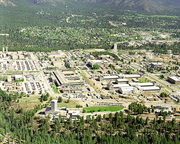
| 설명 | Aerial view of Los Alamos National Laboratory, "1995 aerial TA-3 south to north". |
| 출처 | http://www.lanl.gov/worldview/news/photos/aerials.shtml |
| 저자 | Los Alamos National Laboratory |
| 대상 위치 | | 이 지역의 다른 사진을 보기: OpenStreetMap |
|---|
|
This is an image of a place or building that is listed on the National Register of Historic Places in the United States of America. Its reference number is 66000893. |

|
그림 자체에 표시되었던 저작자의 이름, 이메일, 웹사이트 또는 서명과 같은 저작자표시 정보는 이미지 메타데이터나 파일 설명 문서로 옮겨졌습니다. 이는 보다 재이용하기 쉽게 하며 언어 중립적이고 텍스트를 처리하고 검색하기 쉽게 하기 위함입니다. 공용은 그림 자체에 저작자 정보를 눈에 띄게 표시하는 것을 권장하지 않습니다.
|
라이선스

|
This image comes from Los Alamos National Laboratory, a national laboratory privately operated under contract from the United States Department of Energy by Los Alamos National Security, LLC between October 1, 2007 and October 31, 2018. LANL allowed anyone to use it for any purpose, provided that the copyright holder is properly attributed. Redistribution, derivative work, commercial use, and all other use is permitted. LANL requires the following text be used when crediting images to it: (link)
Unless otherwise indicated, this information has been authored by an employee or employees of the Los Alamos National Security, LLC (LANS), operator of the Los Alamos National Laboratory under Contract No. DE-AC52-06NA25396 with the U.S. Department of Energy. The U.S. Government has rights to use, reproduce, and distribute this information. The public may copy and use this information without charge, provided that this Notice and any statement of authorship are reproduced on all copies. Neither the Government nor LANS makes any warranty, express or implied, or assumes any liability or responsibility for the use of this information. |
|
파일 역사
날짜/시간 링크를 클릭하면 해당 시간의 파일을 볼 수 있습니다.
| 날짜/시간 | 섬네일 | 크기 | 사용자 | 설명 | |
|---|---|---|---|---|---|
| 현재 | 2011년 6월 26일 (일) 23:22 | | 1,435 × 1,153 (757 KB) | Keraunoscopia | removed watermark |
| 2005년 5월 8일 (일) 18:18 |  | 1,435 × 1,153 (750 KB) | Floriang | Aerial view of Los Alamos National Laboratory, "1995 aerial TA-3 south to north", from http://www.lanl.gov/worldview/news/photos/aerials.shtml ''Source:'' en.wikipedia.org, upload by Fastfission {{PD-USGov}} [[Category:Bi |
이 파일을 사용하는 문서
다음 문서 3개가 이 파일을 사용하고 있습니다:
이 파일을 사용하고 있는 모든 위키의 문서 목록
다음 위키에서 이 파일을 사용하고 있습니다:
- ar.wikipedia.org에서 이 파일을 사용하고 있는 문서 목록
- bg.wikipedia.org에서 이 파일을 사용하고 있는 문서 목록
- bn.wikipedia.org에서 이 파일을 사용하고 있는 문서 목록
- bo.wikipedia.org에서 이 파일을 사용하고 있는 문서 목록
- br.wikipedia.org에서 이 파일을 사용하고 있는 문서 목록
- ca.wikipedia.org에서 이 파일을 사용하고 있는 문서 목록
- cs.wikipedia.org에서 이 파일을 사용하고 있는 문서 목록
- da.wikipedia.org에서 이 파일을 사용하고 있는 문서 목록
- de.wikipedia.org에서 이 파일을 사용하고 있는 문서 목록
- el.wikipedia.org에서 이 파일을 사용하고 있는 문서 목록
- en.wikipedia.org에서 이 파일을 사용하고 있는 문서 목록
- Fermi paradox
- Los Alamos National Laboratory
- Theodore Hall
- Bechtel
- Albuquerque–Santa Fe–Los Alamos combined statistical area
- List of National Historic Landmarks in New Mexico
- National Register of Historic Places listings in Los Alamos County, New Mexico
- User:CM at Bechtel/Major projects table
- Draft:Triad National Security
- en.wikiversity.org에서 이 파일을 사용하고 있는 문서 목록
- eo.wikipedia.org에서 이 파일을 사용하고 있는 문서 목록
- es.wikipedia.org에서 이 파일을 사용하고 있는 문서 목록
- et.wikipedia.org에서 이 파일을 사용하고 있는 문서 목록
- eu.wikipedia.org에서 이 파일을 사용하고 있는 문서 목록
- fa.wikipedia.org에서 이 파일을 사용하고 있는 문서 목록
- fi.wikipedia.org에서 이 파일을 사용하고 있는 문서 목록
- fr.wikipedia.org에서 이 파일을 사용하고 있는 문서 목록
- gl.wikipedia.org에서 이 파일을 사용하고 있는 문서 목록
- ha.wikipedia.org에서 이 파일을 사용하고 있는 문서 목록
- he.wikipedia.org에서 이 파일을 사용하고 있는 문서 목록
이 파일의 더 많은 사용 내역을 봅니다.